Trip Summary: Whangarei to Tawharanui Regional Park Drive
Whangarei to Tawharanui Regional Park Road Trip Adventure Awaits on Your Scenic Drive The journey starts in Whangarei, covering 97 km of picturesque landscapes and charming locales before reaching Warkworth. Expect the drive to take approximately 1 hour and 16 minutes, allowing ample time to enjoy interesting stops along the way. Key points of interest include Otaika and Ruakaka, perfect for a quick break or photo opportunity.
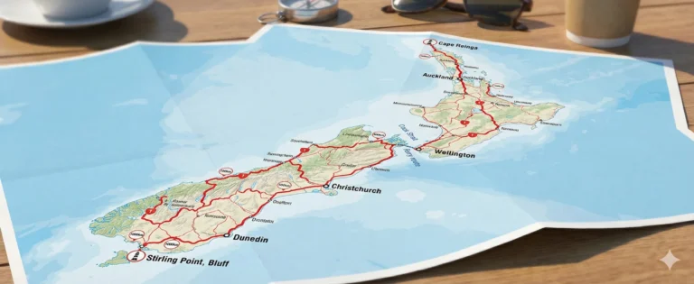
Route Map & Driving Directions
Plan Your Whangarei to Tawharanui Regional Park Trip
Journey Milestones
View Road Trip Itinerary (122 km, 1 hour 51 mins)
Drive from Whangarei to WarkworthApprox 96.8 km, taking 1 hour 16 mins.
Drive from Warkworth to Tawharanui Regional ParkApprox 24.5 km, taking 32 mins.
Pro Tips for Your Whangarei to Tawharanui Regional Park Road Trip
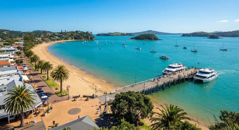
- Fill up at Auckland North for the cheapest fuel price on your route. Warkworth offers cafes and shops for refreshments during your break. Consider stopping at Ruakaka for striking coastal views.
Fuel Prices: Whangarei to Tawharanui Regional Park
Updated: 2026-04-22 18:38
Places to See Along the Whangarei to Tawharanui Regional Park Route
Places to Visit
Town/City
Otaika
0.0 km off-route
Town/City
Ruakaka
0.0 km off-route
Food & Cafés
Restaurant
The Marina Cafe and Restaurant
6.5 km off-route
★ 4.4
1/30 Rauiri Drive, Marsden Bay Drive, One Tree Point 0118
View on Maps Where to Stay
Campground
Whangateau Holiday Park
4.4 km off-route
★ 4.6
559 Leigh Road, Whangateau 0985
View on Maps Gas Stations
Gas station
GAS Waipu
1.2 km off-route
★ 4.3
24/28 The Centre, Waipu 0510
View on Maps
Gas station
Caltex Maungaturoto
7.2 km off-route
★ 4.4
198 Hurndall Street West, Maungaturoto 0520
View on Maps Adventure Awaits on Your Scenic Drive
The journey starts in Whangarei, covering 97 km of picturesque landscapes and charming locales before reaching Warkworth. Expect the drive to take approximately 1 hour and 16 minutes, allowing ample time to enjoy interesting stops along the way. Key points of interest include Otaika and Ruakaka, perfect for a quick break or photo opportunity.
Following your visit to Warkworth, the last leg of your journey takes you 25 km to Tawharanui Regional Park, a route that should take about 32 minutes. Along this final stretch, you can explore the serene Whangateau Holiday Park, a great spot for a picnic or to stretch your legs. When planning your fuel stops, keep in mind that fuel tends to be priced approximately 4% cheaper at Auckland North compared to Auckland South, and around 6% cheaper than in Auckland CBD.

Key Takeaways
- EV drivers use PlugShare for locating charging stations.
- Download offline maps before starting your journey from Whangarei.
- Check all signage for directions and points of interest along the route.
Pro Tips
Fuel Estimates
| Vehicle Type | Litres | Cost |
|---|
| Economic hybrid | 4.9 L | ~$12 |
| Cheap car | 9.8 L | ~$24 |
| Van | 12.2 L | ~$30 |
| Ute | 14.6 L | ~$36 |

Frequently Asked Questions
Where can I find the cheapest petrol on the way from Whangarei to Tawharanui Regional Park?
Fuel prices in New Zealand can fluctuate significantly between regions. As of today, the most competitive price we've tracked is $3.12/L at Auckland North. We generally find that filling up in larger hubs like Whangarei before heading into more rural stretches can save you a decent amount on your total trip cost.
How much time should I realistically allow for the drive between Whangarei and Tawharanui Regional Park?
While the direct driving time is approximately 2 hr, we always recommend allowing an extra 30 to 45 minutes. New Zealand roads can be winding, and you may encounter slow-moving vehicles or roadworks. It's much better to arrive relaxed at Tawharanui Regional Park than to rush through the beautiful scenery.
What is the total distance for this trip and what is the road like?
The trip covers about 122 km. The route primarily follows State Highway 1, which is a well-maintained stretch of road. You can expect a mix of open highway and some more technical, winding sections as you get closer to Tawharanui Regional Park, so keep an eye on your speed and enjoy the views.
Will I encounter any toll roads while driving to Tawharanui Regional Park?
Depending on the exact path you take, you might encounter tolls (such as the Northern Gateway, Tauranga Eastern Link, or Takitimu Drive). These are clearly signposted. Most rental cars have their plates automatically read; just ensure you check your rental agreement regarding how these tolls are processed to avoid admin fees.
How much should I budget for fuel for a one-way trip from Whangarei?
Based on the current average price of $3.12/L, a standard economy rental car will likely use about $33 worth of fuel for this journey. If you're driving a larger SUV or van, we suggest adding about 20-30% to that estimate to be safe.
Are there good places to stop for a coffee or a stretch between Whangarei and Tawharanui Regional Park?
Absolutely! Passing through Otaika is a great opportunity to take a break. There are several local cafes and public rest areas where you can grab a flat white and stretch your legs. Breaking up the drive every 90 minutes is the best way to stay alert on New Zealand roads.
Is it easy to find EV charging stations along this specific route?
Yes, the infrastructure for electric vehicles is quite good here. You'll find rapid DC chargers in both Whangarei and Tawharanui Regional Park, as well as at least one charging station in Otaika. We recommend using the 'PlugShare' app to check real-time availability before you depart.
What is the best time of day to leave Whangarei to avoid heavy traffic?
To have the smoothest run, we suggest avoiding the weekday morning rush (7:00 AM – 9:00 AM) and the afternoon peak (4:00 PM – 6:00 PM) specifically around Whangarei. Leaving mid-morning or early afternoon usually results in a much more peaceful drive with fewer delays.
Are there 24-hour petrol stations available if I'm driving late at night?
Main centres like Whangarei have several 24-hour options. Once you are on the open road toward Tawharanui Regional Park, many stations switch to 'unattended' mode, meaning you can still get fuel using a credit or debit card with a PIN at the pump terminal.
Do I need to worry about snow or ice on the road to Tawharanui Regional Park?
Most of this route stays at lower altitudes, so snow is very rare. However, during winter months (June–August), black ice can occasionally form in shaded areas around mountain passes in the early morning. If you're driving in winter, just take it easy until the sun is fully up.
Are there any dog-friendly parks or walks on the way?
If you're travelling with a furry friend, the local reserve in Otaika is a fantastic spot. It has plenty of space for dogs to run. Just remember to keep them on a lead in any national park areas or near farmland where livestock might be present.
Which part of the drive offers the best photo opportunities?
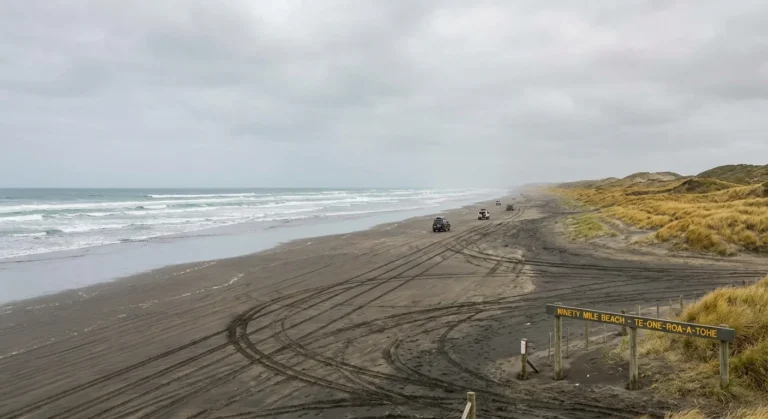
Keep your camera ready as you pass through Tawharanui Regional Park. There are several safe 'lookout' pull-over bays where you can get a great shot of the rolling hills and scenic countryside. It's one of the most iconic views on the drive to Tawharanui Regional Park.
Is this route suitable for all types of rental vehicles?
Yes, the road is fully sealed (bitumen) all the way from Whangarei to Tawharanui Regional Park. Whether you've hired a small compact car, a hybrid like our Nissan Notes, or a larger family SUV, you'll find the road conditions perfectly suitable.
Where is the best place to stop for a proper meal?
For more than just a quick snack, Otaika has the best selection of local pubs and restaurants. It's roughly halfway, making it the perfect spot for a lunch break before finishing the second half of your trip to Tawharanui Regional Park.
How is the mobile phone coverage along the highway?
You'll have a strong signal through most of the trip, especially near towns. However, New Zealand's terrain means there are occasional 'dead zones' in deep valleys or remote stretches. We recommend downloading your offline maps before you leave Whangarei just in case.
Where are the cleanest public toilets located on this route?
New Zealand is great for this! Most small towns have very clean public facilities. The ones in Otaika (usually near the local library or i-SITE) are particularly well-maintained and easy to access from the main road.
Should I be on the lookout for speed cameras?
Safety is a priority on our roads. There are often fixed speed cameras near Otaika, and mobile police units are common on the open road. Always stick to the 100km/h limit (or lower as signposted) to ensure a safe trip and avoid fines.
Is it better to fill up the tank now in Whangarei or wait?
Our live data shows that Whangarei is currently cheaper than Tawharanui Regional Park. If your tank is less than half full, we'd recommend topping up at Auckland North now to take advantage of the better rate before you hit the more expensive regions.
Are there plenty of overtaking lanes on this highway?
Yes, this route is designed with safety in mind. There are dedicated passing lanes every few kilometres. If you find a queue of cars behind you, please use the 'slow vehicle bays' to let others pass safely—it makes the drive better for everyone!
What kind of hazards or wildlife should I watch out for?
The most common thing to watch for is wandering livestock or birds like Pukekos near the roadside in rural Tawharanui Regional Park. Also, keep an eye on the weather; heavy rain can cause localized surface flooding on some of the lower-lying sections of the road.